


The most famous and ancient of the Roman roads, also known as Regina Viarum, the Appian Way was born at the end of the 4th century BC. when in 312 Appio Claudio Cieco was censor, the same to whom we owe the first aqueduct of the city. For the first time, a street takes its name from its builder and not from its function (Via Salaria is related to salt) or from the place where it leads (Via Praenestina, Via Tiburtina, Via Nomentana). It was built by pointing straight to the goal, overcoming great natural difficulties with relevant engineering works.
Initially, the route included only the stretch from Rome to Capua. Later, it was extended to Benevento, then, beyond the Apennines, to Venosa, and then to Taranto. Finally, before 191 BC, to Brindisi, where two columns, one of which is still present, indicated its endpoint.
In the ancient sections that have best reached us, the roadbed is called basolato, a term that takes its name from the antique paving slabs made up of huge blocks of volcanic basalt. The carriageway allowed the simultaneous passage of two wagons in both directions. It was flanked by two pavements in compacted earth, delimited by a stone curb (crepidine).
Running along the seaside and being set back from the war front, the road was faster and safer than Via Latina and soon took on military and strategic function. Near the inhabited centers, it was flanked by large villas and above all by tombs and funerary monuments of various kinds.
With the fall of the Roman Empire, the road was abandoned and remained unused for a long time. Throughout the Middle Ages, pilgrims used it because of the catacombs and because from Brindisi, they could embark for the Holy Land. It was only in the Renaissance that its slow recovery began, thanks to the efforts of numerous archaeologists and enthusiasts who contributed, together with the most recent interventions, to restoring the Appia Antica as we know it today.
On foot or by bicycle, the Appian Way allows a walk surrounded by greenery to discover important funerary monuments, villas, and catacombs.
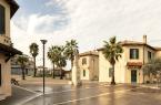
But let's start from the beginning. After the Aurelian Walls were built, people entered the city from the Porta Appia, today Porta San Sebastiano. The Museum of the Walls is located inside Porta San Sebastiano, one of the largest and best-preserved of the Aurelian Walls. Its permanent exhibition is divided into three sections: ancient, medieval, and modern. With free admission, the museum traces the history of the city's fortifications, as well as the historical and architectural events of the Aurelian Walls.
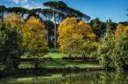
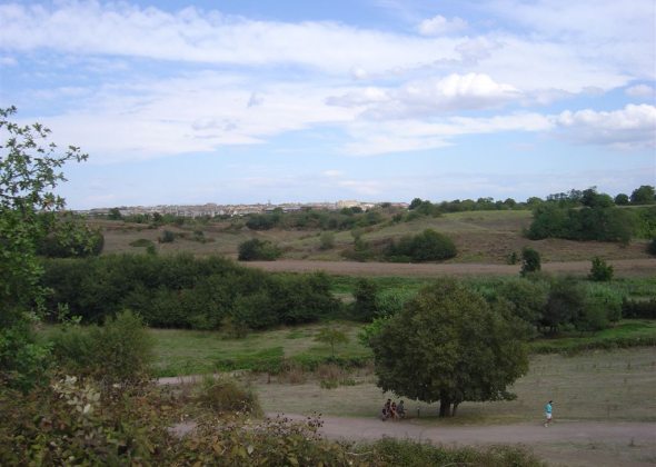
From Porta San Sebastiano, the Parco Regionale dell'Appia Antica extends for 3500 hectares. They include the first 11 miles of the Regina Viarum, the Caffarella Valley, and the Aqueducts area.
After crossing the Amone river, before embarking on the Appian Way, you can make a short detour to the right: in Via Ardeatina, you can visit the Fosse Ardeatine. In these quarries, 335 prisoners were brutally murdered on 24 March 1944 by the German occupation troops in retaliation for the 33 comrades killed during a war action by the partisans in Via Rasella. Among the 335 random victims, there were several political prisoners from the Via Tasso prison, numerous Jews, and some civilians.
Today, the place is one of the monuments to the values of the Resistance. At the entrance, a group of three travertine figures idealizes the fallen. A tunnel enters the ancient pozzolana quarry and leads to the massacre place, where the shrine stands.
If, on the other hand, you avoid this detour and take the Appian Way directly, you will find the Catacombs of Saint Callistus, the oldest and best-preserved cemetery on the Appian Way at number 110/126.
A little further on the 3rd mile, on the place where according to tradition, the bodies of apostles Peter and Paul were temporarily kept in times of persecution, stands the Basilica of San Sebastiano, today dedicated to this famous - and very reproduced - Narbonese saint. Formerly, the basilica was known as basilica apostolorum. From this place, mentioned in ancient sources as ad catacumbas (perhaps for the presence of valleys or pits, kymbas in Greek), the term "catacomb" would also derive by extension. From a staircase located in what, before the seventeenth-century restructuring, was the right aisle of the church, you can go down to the vast complex of the Catacombs of San Sebastiano.
About two hundred meters after San Sebastiano, on the left, are the ruins of the Villa of Maxentius. The archaeological complex, which extends between the second and third miles of the Appian Way, consists of three main buildings: the palace, the circus, and the dynastic mausoleum, designed in an inseparable architectural unity to celebrate Emperor Maxentius, the unfortunate opponent of Constantine the Great in the battle of Ponte Milvio in 312 AD. The dynastic mausoleum, also known as the "Tomb of Romulus" after the young son of the Emperor who was presumably buried here, stands inside a four-sided portico aligned on the Via Appia Antica.
Immediately after the complex of the circus of Maxentius and the Mausoleum of Romulus stands one of the most important funerary monuments, the Mausoleum of Cecilia Metella. It consists of an imposing square base on which a cylinder covered with travertine slabs, decorated at the top by a marble frieze with festoons and ox heads, is placed. Above the entrance, there is an inscription with the name of the tomb owner, Cecilia Metella, the daughter of Quinto Metello Cretico, the consul who conquered Crete in 67 BC. During the Middle Ages, the tomb became an essential control point. In the 11th century, it was incorporated into the fortifications of a castle built by the Counts of Tusculum. In 1299, Pope Boniface VIII had the castle transformed into a fortified citadel surrounded by a crenelated wall with rectangular towers, including a church dedicated to St. Nicholas.
After the Casale Torlonia (at number 240), the road runs free and flanked by pines and cypresses with numerous remains of easily accessible tombs. On the left, walled up on a 19th-century "wing" of bricks, are the fragments and the epigraph from the monument of Marco Servilio. After a stretch of ancient paving is the nucleus of a room tomb and the grave of freedman Sesto Pompeo Giusto sons on which a large epigraph in verses is engraved.
On the right side, you can notice the well-preserved ruins of the rear part of a rectangular temple-shaped sepulcher with a high podium and staircase. You can also see the frontispiece tomb, resting on a flint Pavillion-shaped high core, with a copy of the relief with four busts, from the second half of the 1st century BC. Continuing our walk, after the medieval farmhouse of Santa Maria Nova, the great ruin of a pyramid-shaped tomb rises.
About 100 meters further on, on the right, there are the so-called Tumuli degli Orazi and, after less than 150 meters, on the left, the Villa of the Quintili overlooks. This is the largest suburban villa in Rome, located on the 5th mile of the Appian Way, an area where, according to tradition, the fight between the Horatii and the Curiazi took place. The villa belonged to the two brothers Sesto Quintilio Condiano and Sesto Quintilio Valerio Massimo, important personalities of the time of Antoninus Pius and Marcus Aurelius, consuls in 151 AD. The present entrance to the villa is from Via Appia Nuova, where an Antiquarium is set up. On the side facing the Appian Way, the remains of a monumental nymphaeum are visible. It was transformed into a castle in medieval times and was the original entrance to the villa.
Proceeding, other evident remains are: a headless statue, the largest mausoleum of the Appian Way, called Casal Rotondo, and on the left Torre Selce, built in the 12th century over the nucleus of a mausoleum that must have been similar to that of Cecilia Metella.
From a distance, on the left, you can see the arches of the aqueduct that supplied the Villa dei Quintili.
 Condividi


